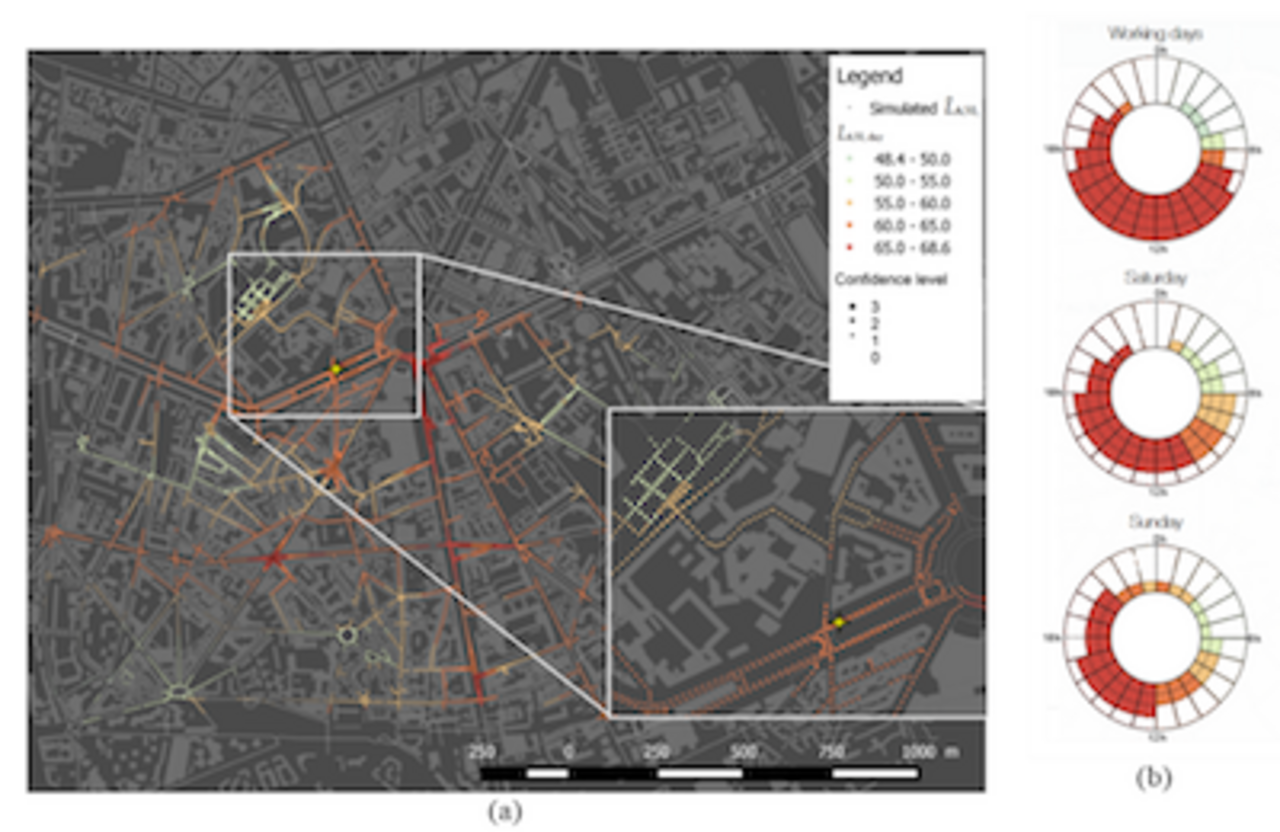
NoiseCapture is being developed jointly with the CNRS as part of the European ENERGIC-OD project that is co-financed by the GEOPAL programme. This Android application can perform geo-localised measurements of sound levels in outdoor environments. The collected data is transferred anonymously to a server that aggregates the contributions of all users to create maps. These maps can be viewed in real time on a dedicated website, and are the outcome of acoustic and geographical analyses. While for the time being they provide information only on the instantaneous sound environment, the maps will eventually provide the public and communities with access to acoustic indicators that show noise exposure. The application was the subject of several presentations at the Consultation on the Quality of the Noise Environment that was held in Paris in 2017.
Understanding, assessing and mitigating impacts on the environment and the population
Air pollution and noise are the two main transport externalities with proven adverse health impacts. Although considerable progress has been made in recent years to limit vehicle emissions, much remains to be done and our cities regularly experience pollution peaks.
When it comes to pollution, it is important to better characterise the pollution emitted by vehicles, but also to consider its ultimate fate in the soil and water. In order to acquire a shared perception of the problem, researchers from several IFSTTAR laboratories joined forces for an in-house network leadership initiative on pollutants moderated by Mathieu Goriaux and Yao Liu. This initiative made it possible to set up an information exchange network on methods for measuring pollutants in water, the air and the soil. The principal results obtained by teams from several laboratories and the wide variety of pollution fields investigated were presented at a seminar organised on 13 June 2017 in Nantes.
With regard to atmospheric pollutant emissions, IFSTTAR continued its efforts to characterise the regulated or unregulated pollutants emitted by vehicles. In particular, the Institute has studied the impact of different types of engine technology and driving on emissions of unregulated pollutants. The EMI 2-4 study, for example, focused on the emissions of two-wheelers and light motorized quadricycles, which have so far been poorly regulated and little studied.
The fate of these pollutants is also the subject of important research: changes in the concentration of particulates, PAHs (polycyclic aromatic hydrocarbons) and atmospheric mercury as one moves away from the infrastructure; the deposition of platinum in the urban environment as well as mercury and palladium in roadside ecosystems. The characterisation of pollutants in urban stormwater requires research into the sampling method and the ranking of the ever-increasing number of substances to be analysed. The development of urban gardens on land that has been slightly contaminated by previous activities also raises the question of the characterisation of pollutants in soils.
The EMI 2-4 project: analysis of the emissions from motorised two-wheelers and quadricycles
The pollutant emissions from motorised two-wheelers and quadricycles are still insufficiently known and regulated. The pollutant emission ceilings set for their type approval were overdue or even absent for diesel-powered quadricycles until 2017. Their engines consequently lack catalytic converters, EGR valves or particle filters.
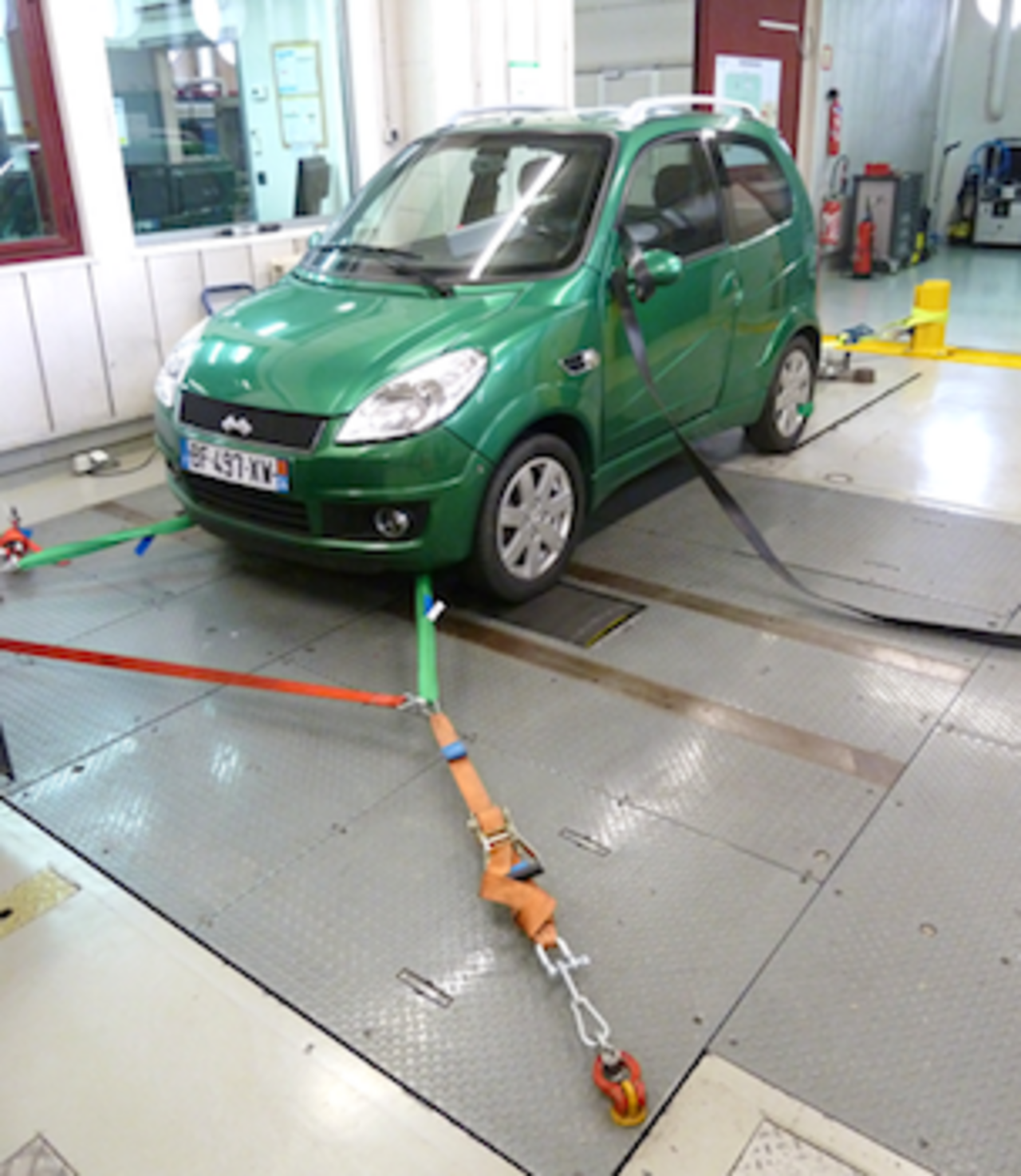
The EMI 2-4 project updated the real emissions data for motorised two-wheelers on the basis of new data on unregulated compounds and, for the first time, assessed the pollutant emissions of diesel-powered light quadricycles. Tailpipe emissions were measured on three light motorised quadricycles for two regulatory driving cycles and one real-life cycle developed by the LTE, as well as on four scooter models tested during three driving cycles on the UTAC-CERAM dedicated test facility. For all the vehicles, gaseous pollutants - including many unregulated compounds - as well as particulate matter by mass and number were monitored ($volatile organic compounds).
In the case of two-wheelers, the study confirmed that the two-stroke engine is responsible for extremely high hydrocarbon pollution, or total HC, with an emission factor of more than 10 g/km (1,000 times higher than that of a recent petrol car). This type of engine also emits very large amounts of benzene, toluene (more than 3 g/km) and aldehydes.
Quadricycles also pollute more than current diesel cars under the same urban driving conditions: the quantities of CO emitted are 2 to 5 times higher and up to 14 times higher in the case of the direct injection model. The respective factors for HC emissions are 4 to 6 and up to 50 for the direct injection quadricycle. Lacking filters, the three quadricycles also had high particulate emissions, equivalent to Euro 0 to Euro 2 diesel cars (1990-1995). Direct injection is only better in terms of NOx emissions, but with a less favourable NO2 ratio, which is the most harmful of the relevant oxides of nitrogen.
In the future, further assessments will be needed to measure the impact of the more stringent regulatory limits that came into force in 2017 (Euro 4).
Noise is also a major environmental problem. A recent study commissioned by ADEME estimated the social cost of transport noise at over €20 billion per year. For several years, IFSTTAR has been developing models to predict noise, its emission at source and its propagation. More recently, assessment tools have been developed, particularly in order to produce noise environment maps.

of LTE measurement facility.
NoiseCapture: a smartphone application for noise environment mapping
The GRAFIC project
ADEME, Arnaud Can, UMRAE, in partnership with Université de Cergy-Pontoise, University of Gand, Bruitparif and The Paris City Authorities
The development of decision support tools and tools for characterising urban noise environments, which are consistent from a qualitative point of view, is a major challenge. The goal of the GRAFIC project was to combine two recent innovative approaches in order to provide ways forward for achieving the continuous mapping of urban noise environments that is coherent from the perceptual and physical points of view: mapping of noise levels which is based on mobile data and the characterisation of noise environments from the perceptual point of view.
New methods for mapping noise levels, based on geo-referenced mobile measurements, have recently been developed. They have the advantage that they consider all sound sources, provide very high spatial resolution coverage, and reduce mapping costs. In addition, recent work has shown that, as well as characterising physical noise levels, it is necessary to develop tools that place greater emphasis on the qualitative aspects of noise environments, as these cannot be merely considered from their energy dimension. The aim is to take better account of people's exposure and discomfort in the presence of noise.


![[Translate to Anglais:] NoiseCapture [Translate to Anglais:] NoiseCapture](/fileadmin/_processed_/4/7/csm_noisecaptureapplication_405ce79a33.jpg)
